
A Voyage to Terra Australis…
A Voyage to Terra Australis; undertaken for the purpose of completing the discovery of that vast country, and prosecuted in the years 1801, 1802, and 1803, in His Majesty's Ship the Investigator…
London: G. and W. Nicol, 1814 (atlas issued circa 1830).
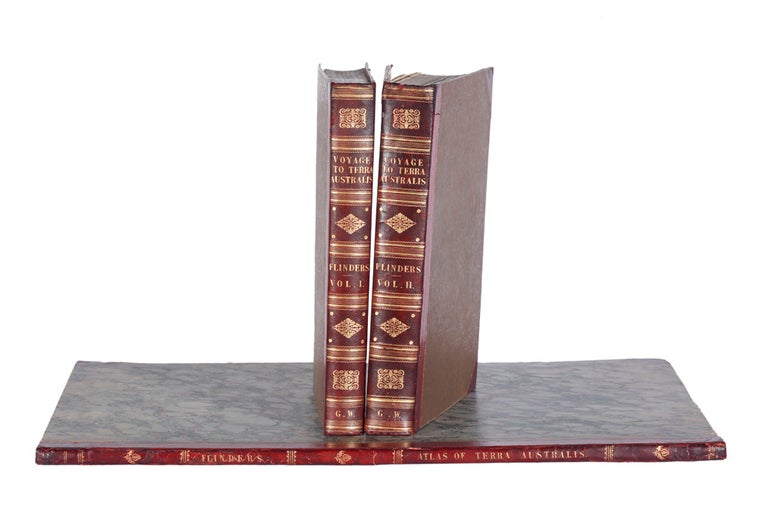
Two volumes quarto, and atlas folio; the text volumes on large paper and the atlas in the preferred elephant folio size with the botanical plates unfolded; nine plates in the text; the atlas with 16 charts (nine folding), two plates (on four double-page sheets) of coastal views, and ten large botanical plates; text in handsome contemporary half crimson morocco bindings with brown moiré cloth sides, atlas in contemporary quarter red morocco and marbled sides, spine lettered in gilt.
From the library at Petworth House, text on Large Paper and atlas updated to 1836
A superb set, evidently acquired by George Wyndham (later Lord Egremont) in 1836, with the splendid and large atlas volume containing updated maps appropriate to that date. Showing details of coastal exploration carried out by P.P. King and others in the two decades since original publication, this represents the detailed knowledge of the Australian coastline current at the time that Wyndham acquired the set. Its binding is very similar to other books from Wyndham's library that we have handled in recent years. It is typical of books from his library that the text volumes should be examples of the scarce issue on Large Paper, while the atlas, which shows the latest available information, is in the preferred largest format with the fine botanical plates therefore unfolded.
A superb set, evidently acquired by George Wyndham (later Lord Egremont) in 1836, with the splendid and large atlas volume containing updated maps appropriate to that date. Showing details of coastal exploration carried out by P.P. King and others in the two decades since original publication, this represents the detailed knowledge of the Australian coastline current at the time that Wyndham acquired the set. Its binding is very similar to other books from Wyndham's library that we have handled in recent years. It is typical of books from his library that the text volumes should be examples of the scarce issue on Large Paper, while the atlas, which shows the latest available information, is in the preferred largest format with the fine botanical plates therefore unfolded.
The three-volume official account of Flinders's great circumnavigation of Australia in the Investigator offers a complete record of the expedition with an authoritative introductory history of maritime exploration in Australian waters from the earliest times. The text contains a day by day account of the Investigator voyage and Flinders's later voyages on the Porpoise and the Cumberland. Robert Brown's 'General Remarks, geographical and systematical, on the Botany of Terra Australis', which is illustrated by Ferdinand Bauer's botanical plates in the atlas, is printed in an appendix in the second volume. The text is illustrated by William Westall's nine engraved plates in the text and two double-page plates of coastal views in the atlas. These are in many cases the very earliest views of the places visited and discovered on the voyage.
Flinders's charts in the atlas were of such accuracy that they continued to be issued by the Admiralty for decades and form the basis of all modern charts of Australia. The atlas here contains late issues of some of the maps, and thus represents the detailed knowledge of the Australian coastline current around 1836. A number of revised issues of the Flinders atlas were to appear in the twenty years after publication. In this copy, the general map of Australia contains revisions to 1829, while chart X has revisions "to 1826 by Phillip P. King", and charts XI and XII have been completely replaced by sheets 1 and 3 of Phillip Parker King's "Chart of part of the N.E. Coast of Australia", published in 1824. Charts VI, XIV and XV are of the Admiralty issue with rhumb-lines added and the Hydrographical Office stamp. The remaining nine charts are of the first issue. The charts continued to be issued by the Admiralty for decades.
Provenance: From the library of George Wyndham at Petworth House, with his signature on the title-page dated 1836 and his bookplate as Lord Egremont.
Ferguson, 576; Hill, 614; Ingleton, 6487; Kroepelien, 438; Nissen BBI, 637; Stafleu & Cowan, I, 1806; Tooley, pp. 77-9; Wantrup, 67a.
Condition Report: In very attractive condition, the text volumes with minor ageing on a few plates; atlas in fine state.
Price (AUD): $85,000.00
US$58,961.21 Other currencies