Voyage autour du monde. Hydrographie Atlas.
Paris: Arthus Bertrand, 1827.
Folio, with 49 engraved maps (18 folding) and four plates of boats, all in good, crisp impressions; an excellent copy in old French quarter calf over papered boards.
Important mapping of the Pacific from Duperrey's voyage of 1822-25
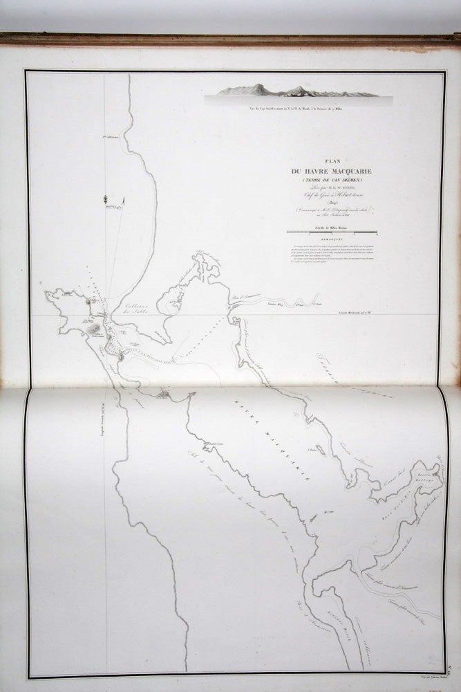
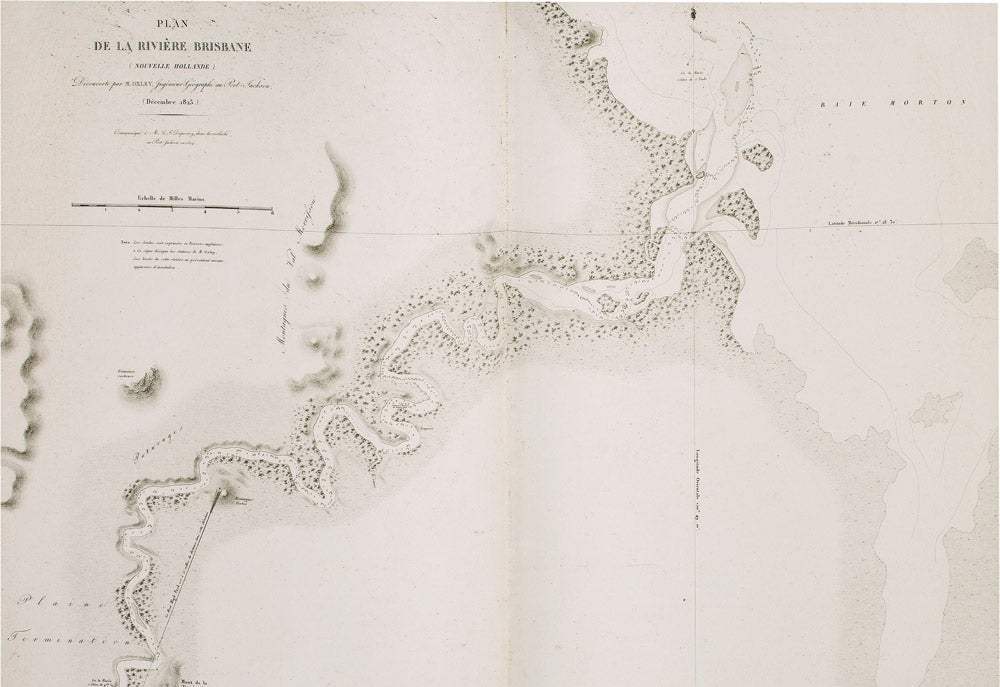
The complete hydrographical atlas from the Duperrey voyage, published as part of one of the immense French grands voyages series. As with most of these publications, the various components could also be bought separately, sometimes even being produced by different publishers. In fact full publication of the Duperrey voyage was never completed. His hydrographic work tended, as Dunmore comments, "towards perfecting existing maps rather than preparing charts of unknown areas". As a result, the beautiful maps clearly display their debt to the earlier explorers, and include the discoveries and vessel tracks of luminaries such as Cook, Bougainville, La Pérouse, Bligh and Flinders.
The complete hydrographical atlas from the Duperrey voyage, published as part of one of the immense French grands voyages series. As with most of these publications, the various components could also be bought separately, sometimes even being produced by different publishers. In fact full publication of the Duperrey voyage was never completed. His hydrographic work tended, as Dunmore comments, "towards perfecting existing maps rather than preparing charts of unknown areas". As a result, the beautiful maps clearly display their debt to the earlier explorers, and include the discoveries and vessel tracks of luminaries such as Cook, Bougainville, La Pérouse, Bligh and Flinders.
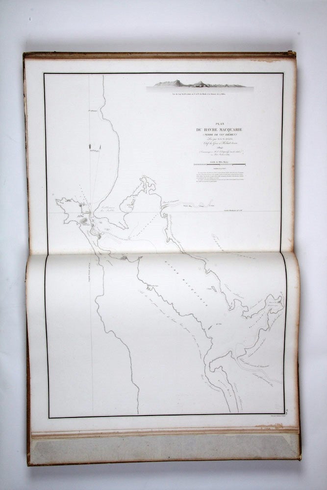
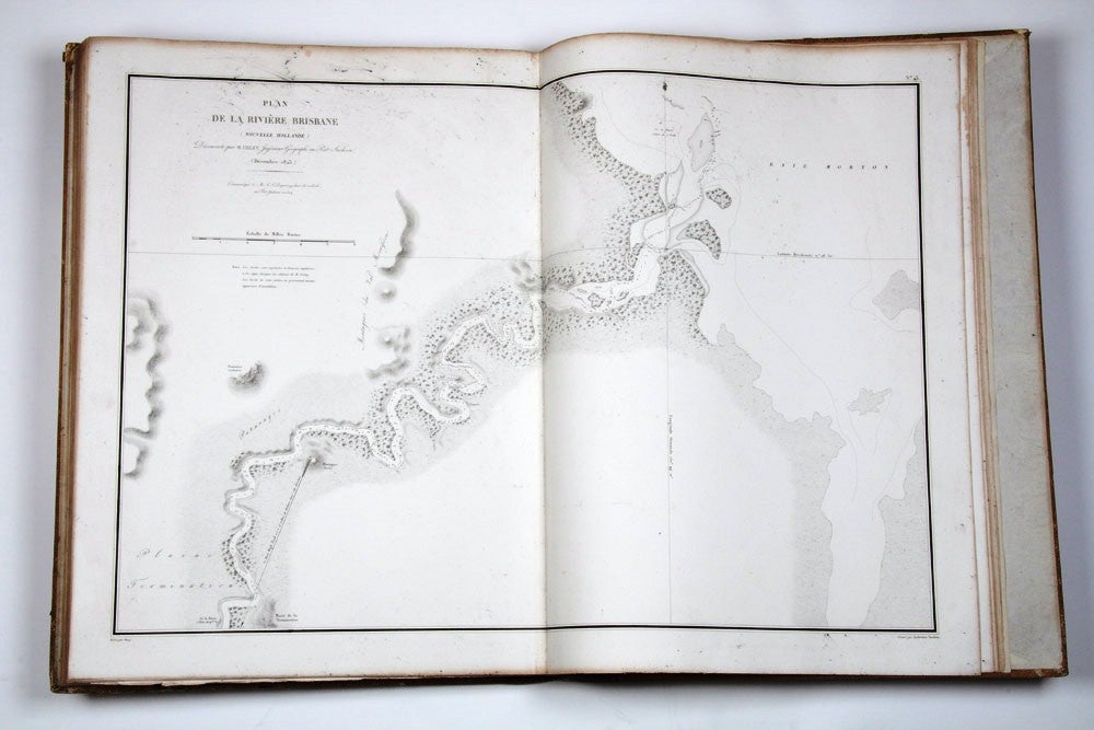
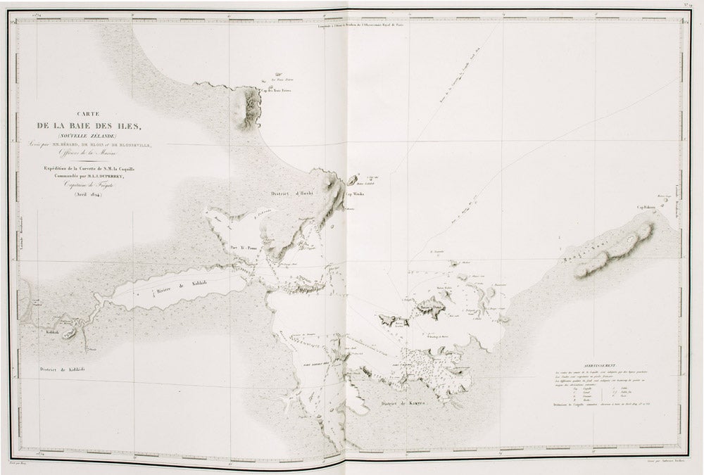
Duperrey's voyage gathered "vast quantities of ethnographic and scientific data" (Hill), and included two visits to the Australian mainland. The details of the harbours at the Brisbane River and Macquarie Harbour in Nouvelle Hollande are attributed in the cartouche to Oxley and Evans respectively. The wonderful map of the Bay of Islands reflects the two weeks that the Duperrey expedition spent there in 1824.
Ferguson, 1069(n); Hill, 517; O'Reilly-Reitman, 822.
Condition Report: Binding a little rubbed, very slightly browned along top edges not affecting images, title-page a little creased.
Price (AUD): $14,000.00
US$9,811.82 Other currencies