Carte de la Nlle. Galles Meridle…
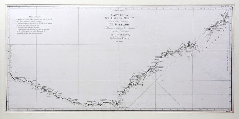
Carte de la Nlle. Galles Meridle. Ou de la Côte Orientale de la Nlle. Hollande Découverte et visitée par le Lieutenant J. Cook…
Paris: Saillant et Nyon, 1774.
Engraved map, 370 x 785 mm.; original folds; mounted.
Point Hicks to Cape York
Perhaps Cook's most famous chart, here in its first French version, prepared for the French language edition of the official account of the Endeavour voyage. The magnificent sweep of the east coast of Australia from Point Hicks to Cape York is testament to Cook's extraordinary achievement on the first voyage. Cook's original manuscript chart is in the British Library. Two contemporary English engraved versions are recorded by David, the version published in Hawkesworth's official account and another, upright in shape, that appears only in Wales' Astronomical Observations (1788). This French version is not recorded by David.
Perhaps Cook's most famous chart, here in its first French version, prepared for the French language edition of the official account of the Endeavour voyage. The magnificent sweep of the east coast of Australia from Point Hicks to Cape York is testament to Cook's extraordinary achievement on the first voyage. Cook's original manuscript chart is in the British Library. Two contemporary English engraved versions are recorded by David, the version published in Hawkesworth's official account and another, upright in shape, that appears only in Wales' Astronomical Observations (1788). This French version is not recorded by David.
Beddie, 860 (English edition) ; David et al, Charts and Coastal Views, 1.270A (English original).
Condition Report: In fine condition.
Price (AUD): $2,200.00
US$1,431.65 Other currencies