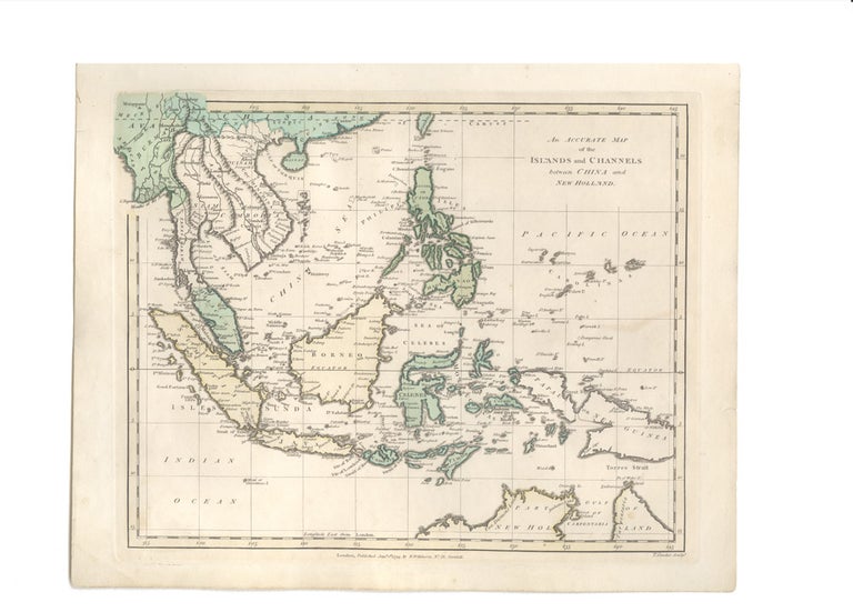
An Accurate Map of the Islands and Channels between China and New Holland.
London: R. Wilkinson, 1 January, 1794.
Engraved map, 265 x 338mm., handcoloured, mounted.
From Port Jackson to Canton
A marvellous map, the companion to Wilkinson's map of the east coast of Australia. This map of South-East Asia is designed to show the islands between Canton at top left and the Torres Strait in the bottom right, giving an overview of the waters which in the 1790s were seeing the beginnings of what would become the established China/India to New Holland trade, with its famous waterways such as the Straits of Sunda and Malacca, and the Sulu Sea. In fact, as an overview of this burgeoning trade, the map could scarcely be bettered.
A marvellous map, the companion to Wilkinson's map of the east coast of Australia. This map of South-East Asia is designed to show the islands between Canton at top left and the Torres Strait in the bottom right, giving an overview of the waters which in the 1790s were seeing the beginnings of what would become the established China/India to New Holland trade, with its famous waterways such as the Straits of Sunda and Malacca, and the Sulu Sea. In fact, as an overview of this burgeoning trade, the map could scarcely be bettered.
The map was originally included in Robert Wilkinson's A General Atlas, being A Collection of Maps of the World (1794).
Condition Report: A fine copy.
Price (AUD): $800.00
US$515.68 Other currencies