
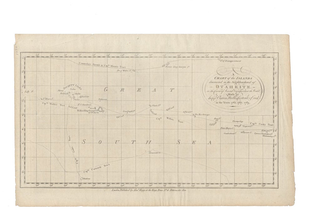
A Chart of the Islands discovered in the Neighbourhood of Otaheite.
London: Alexander Hogg, circa 1780.
Engraved chart, 185 x 355 mm, with decorative title cartouche in the upper right corner.
An early map of the Society Islands in the South Pacific published by Alexander Hogg to illustrate the voyages and discoveries of the sea captains Byron, Wallis, Carteret and Cook. Featuring the routes taken by these important explorers in and around the Society Islands, it depicts the island of Tahiti (Otaheite) as well as Bora Bora (Bolabola), Otaha, Marma, Ulietea, and others.
An early map of the Society Islands in the South Pacific published by Alexander Hogg to illustrate the voyages and discoveries of the sea captains Byron, Wallis, Carteret and Cook. Featuring the routes taken by these important explorers in and around the Society Islands, it depicts the island of Tahiti (Otaheite) as well as Bora Bora (Bolabola), Otaha, Marma, Ulietea, and others.
Price (AUD): $225.00
US$145.03 Other currencies