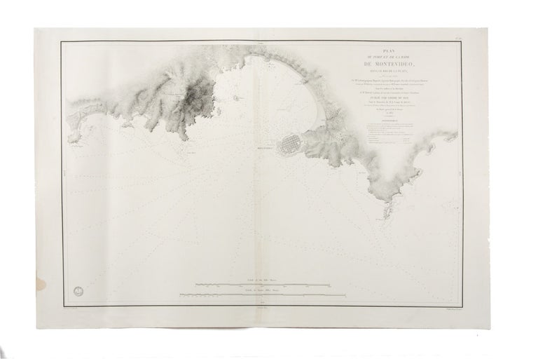
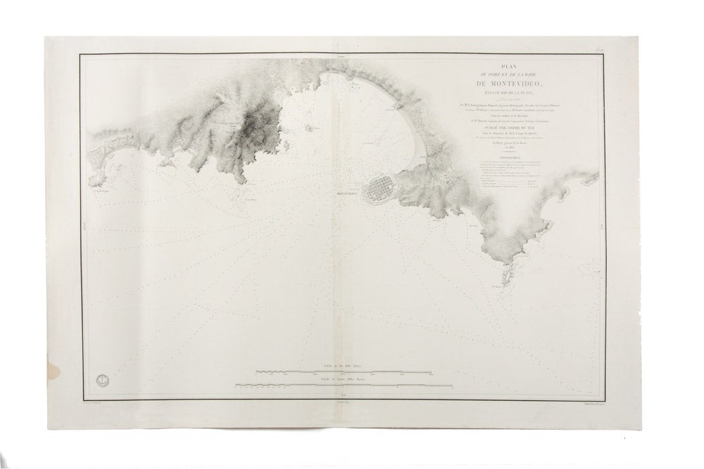
Plan du Port et de la Rade de Montevideo, dans le Rio de la Plata, levé en 1831.
Paris: Dépôt Général de la Marine, 1833.
Engraved chart, two conjoined sheets measuring 655 x 988 mm. in total.
The original township of Montevideo in 1831
Splendid map of the coastline of Uruguay - with detail of the original city grid of Montevideo - from the golden age of French scientific hydrography. The map was produced by the French navy and published by the Dépôt Général de la Marine. Like the Admiralty Office in London, the Dépôt served both as a depository for marine charts and a publishing firm. The intention was to provide accurate and up-to-date charts for the use of the navy and merchant marine.
Splendid map of the coastline of Uruguay - with detail of the original city grid of Montevideo - from the golden age of French scientific hydrography. The map was produced by the French navy and published by the Dépôt Général de la Marine. Like the Admiralty Office in London, the Dépôt served both as a depository for marine charts and a publishing firm. The intention was to provide accurate and up-to-date charts for the use of the navy and merchant marine.
Condition Report: Fine.
Price (AUD): $1,285.00
US$836.22 Other currencies