Carte réduite de la Riviére de la Plata…
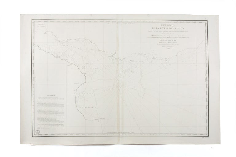
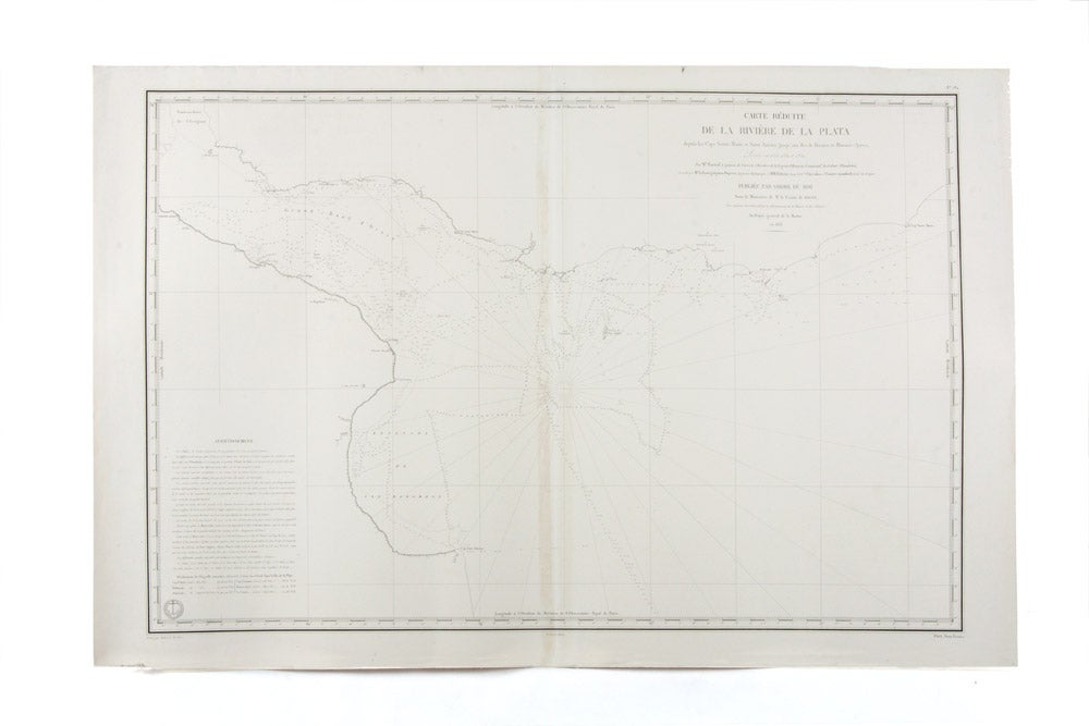
Carte réduite de la Riviére de la Plata depuis les Caps Sainte Marie et Saint Antoine jusqu'aux Iles de Hornos et Buenos-Ayres
Paris: Dépôt Général de la Marine, 1833.
Engraved chart; two conjoined sheets measuring 655 x 988 mm. in total.
Sounding chart for the River Plate.
Sounding chart of the headwaters of the River Plate, with soundings of the approaches to Montevideo.
Sounding chart of the headwaters of the River Plate, with soundings of the approaches to Montevideo.
The map was produced by the French navy and published by the Dépôt Général de la Marine. Like the Admiralty Office in London, the Dépôt served both as a depository for marine charts and a publishing firm. The intention was to provide accurate and up-to-date charts for the use of the navy and merchant marine.
TGhe map is remarkabke for its detail and finesse of esecution.
Condition Report: Fine.
Price (AUD): $1,250.00
US$806.88 Other currencies