
Chart of two islands in the Fijian group…
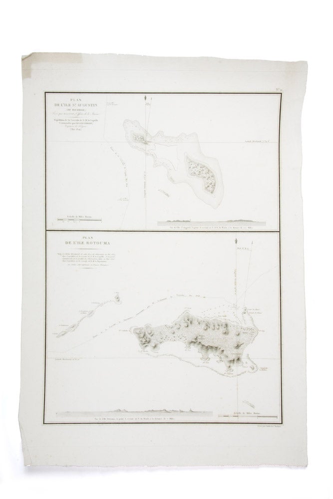
Chart of two islands in the Fijian group captioned "Plan de l'ile St. Augustin (de Maurelle). Levé par M. Lottin, Officer de la Marin… Plan de l'ile Rotouma"
Paris: Artus Bertrand, after 1828.
Engraved chart; 600 x 425 mm.
Duperrey and Tromelin chart Rotuma
Fine chart produced from the results of the Duperrey voyage through the Pacific (1822-1825) showing St. Augustine and Rotouma (modern day Rotuma), outlying islands today under the governance of Fiji. The expedition led by Louis-Isidore Duperrey was typical of nineteenth century scientific voyages, with an emphasis on ethnology, natural history collecting, and accurate cartography and hydrography. The voyage resolved many cartographic ambiguities of scattered Pacific islands north of the equator, and is remarkable its atlas of finely engraved maps. This chart was originally published for inclusion in the hydrographic atlas of the official account (published in numerous parts as Voyage autour du Monde from 1826 to 1830). However, this map is a later issue revised with information gathered in 1828 by the expedition led by Le Goarant de Tromelin in the corvette La Bayonnaise. This is noted in an engraved note below the caption title of the Rotouma map, and the chart itself is marked with the track of La Bayonnaise with soundings recorded.
Fine chart produced from the results of the Duperrey voyage through the Pacific (1822-1825) showing St. Augustine and Rotouma (modern day Rotuma), outlying islands today under the governance of Fiji. The expedition led by Louis-Isidore Duperrey was typical of nineteenth century scientific voyages, with an emphasis on ethnology, natural history collecting, and accurate cartography and hydrography. The voyage resolved many cartographic ambiguities of scattered Pacific islands north of the equator, and is remarkable its atlas of finely engraved maps. This chart was originally published for inclusion in the hydrographic atlas of the official account (published in numerous parts as Voyage autour du Monde from 1826 to 1830). However, this map is a later issue revised with information gathered in 1828 by the expedition led by Le Goarant de Tromelin in the corvette La Bayonnaise. This is noted in an engraved note below the caption title of the Rotouma map, and the chart itself is marked with the track of La Bayonnaise with soundings recorded.
Condition Report: Fine.
Price (AUD): $480.00
US$309.84 Other currencies