
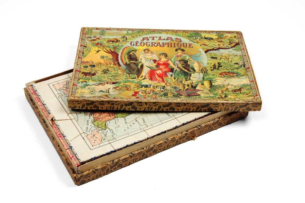
Atlas Géographique.
Paris: Logerot, Pauly, and others, circa 1910.
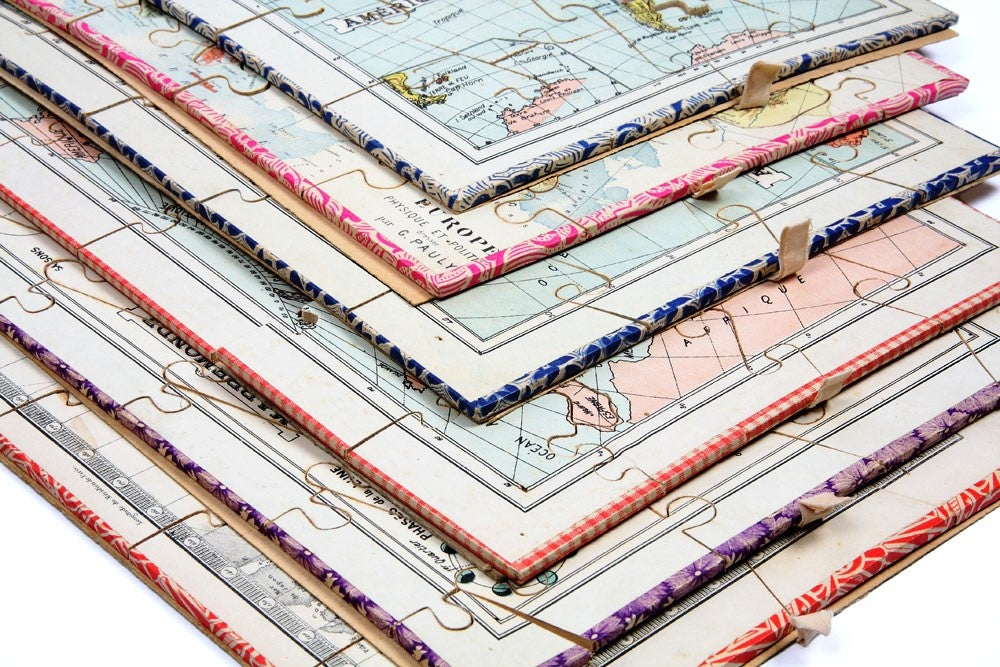
Six map puzzles, each measuring 330 x 240 mm., housed in the original colour printed card case.
Colonial strategy for youngsters
Geographical jigsaw puzzle set comprising six maps mounted and cut into parts corresponding to the colonial dominions of major European powers. This division of the world reflecting European territorial aspirations exemplifies the mood of the first decade of the twentieth century and the rivalry that precipitated the outbreak of the First World War. Accordingly, this puzzle set has an interesting social history dimension as it tangibly demonstrates the overlap between colonialism and early childhood education.
Geographical jigsaw puzzle set comprising six maps mounted and cut into parts corresponding to the colonial dominions of major European powers. This division of the world reflecting European territorial aspirations exemplifies the mood of the first decade of the twentieth century and the rivalry that precipitated the outbreak of the First World War. Accordingly, this puzzle set has an interesting social history dimension as it tangibly demonstrates the overlap between colonialism and early childhood education.
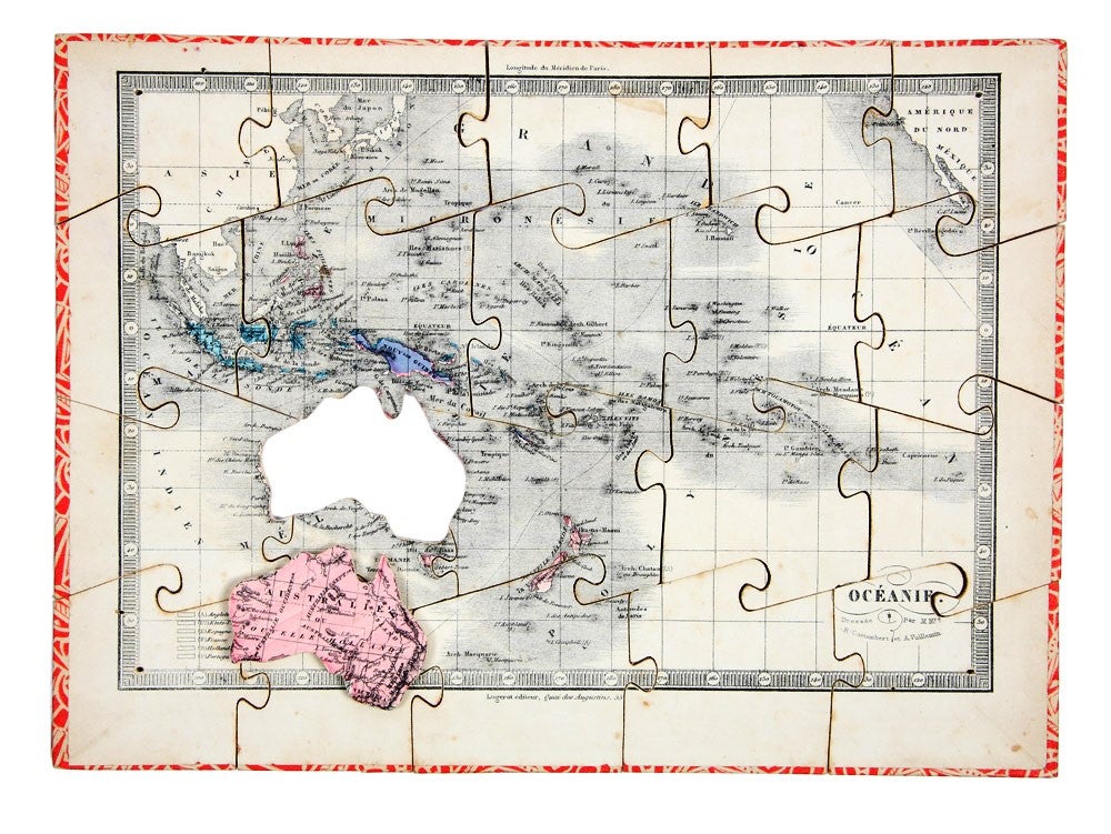
The map of Australasia and the Pacific is captioned Océanie dressée par M. Mrs. R. Cortambert et A. Vuillemin, and bears the imprint 'Logerot éditeur Quai des Augustins, 55'. It is a later printing of an engraved map of the same title published by Hachette in 1852. This lithographed version was prepared circa 1880, and includes a colour key dividing South-east Asia and the Pacific into the respective colonial dominions of England, France, Spain, the United States, Holland and Portugal. As depicted the Australian continent includes good detail of inland geographical features such as Mt. Stuart and Lake Eyre, and the Hammersley Ranges in Western Australia.
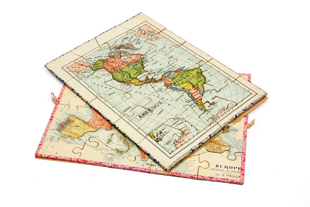
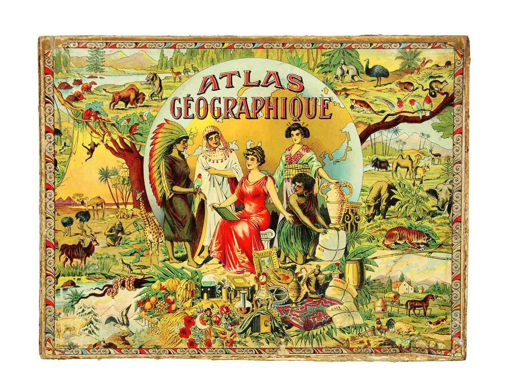
The other five maps in the series are later publications, printed circa 1910, and are contemporaneous with the striking presentation case. They include a double hemisphere world map and the remaining four continents of Europe, Asia, Africa and the Americas. The front board of the presentation case is itself a fine example of period design, with five beauties respectively symbolising each continent amidst a cornucopia of regionally specific natural products and commodities. The borders are ornamented with fauna of each of the continents and Australian animals include the kangaroo, emu, lyrebird, wombat, possum, thylacine and a gang of cockatoos.
Condition Report: In good original condition.
Price (AUD): $1,650.00
US$1,058.70 Other currencies