Map of New Guinea.
Amsterdam: Jansson, 1646.
Engraved map, 185 x 435 mm.; with central fold, in fine condition and mounted.
Across the Pacific to New Guinea
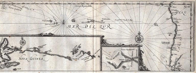
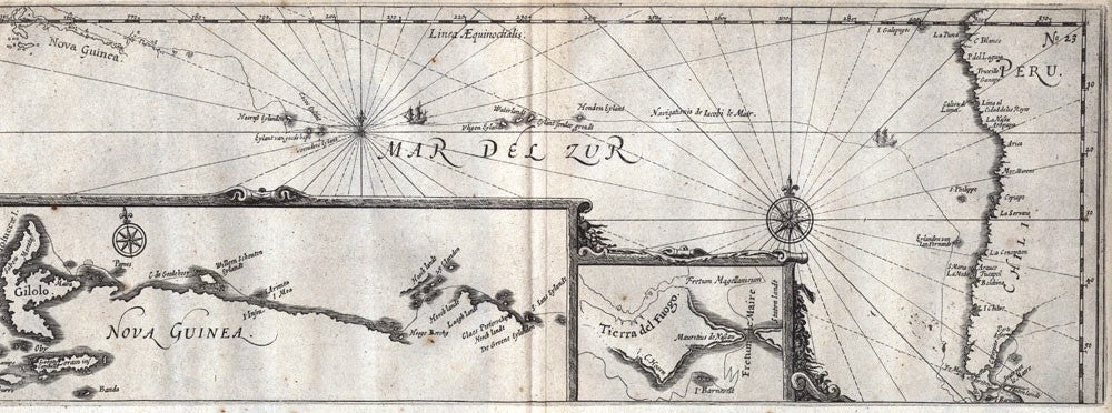
Important early map of the Pacific with insets of the Le Maire Strait and New Guinea from Commelin's compendium of Dutch voyages, Begin Ende Voortgangh. This map comes from the chapter which describes Spilbergen's second voyage to the Moluccas via the Strait of Magellan and the narrative of Le Maire and Schouten's voyage of 1615-1617 to the Australian regions. The momentous Pacific crossing of Le Maire and Schouten was 'the last expedition of the seventeenth century to search for Terra Australis from the east…' (Schilder).
Important early map of the Pacific with insets of the Le Maire Strait and New Guinea from Commelin's compendium of Dutch voyages, Begin Ende Voortgangh. This map comes from the chapter which describes Spilbergen's second voyage to the Moluccas via the Strait of Magellan and the narrative of Le Maire and Schouten's voyage of 1615-1617 to the Australian regions. The momentous Pacific crossing of Le Maire and Schouten was 'the last expedition of the seventeenth century to search for Terra Australis from the east…' (Schilder).
The larger inset shows Le Maire's discoveries along the northern coast of New Guinea, including the detailed voyage track. Of particular interest is the westernmost island depicted, which clearly shows Gilolo. Gilolo or Jailolo, which is situated on Halmahera - the largest island of the Moluccas - was the original home of Giolo, Dampier's "Painted Prince". Giolo and his mother had been captured and sold as slaves at Mindanao to Moody, an English trader. Dampier purchased a half-interest in Giolo, during his trading voyage of 1690 (described in New Voyage round the World, 1697) and returned with him to London.
Price (AUD): $1,450.00
US$934.66 Other currencies