
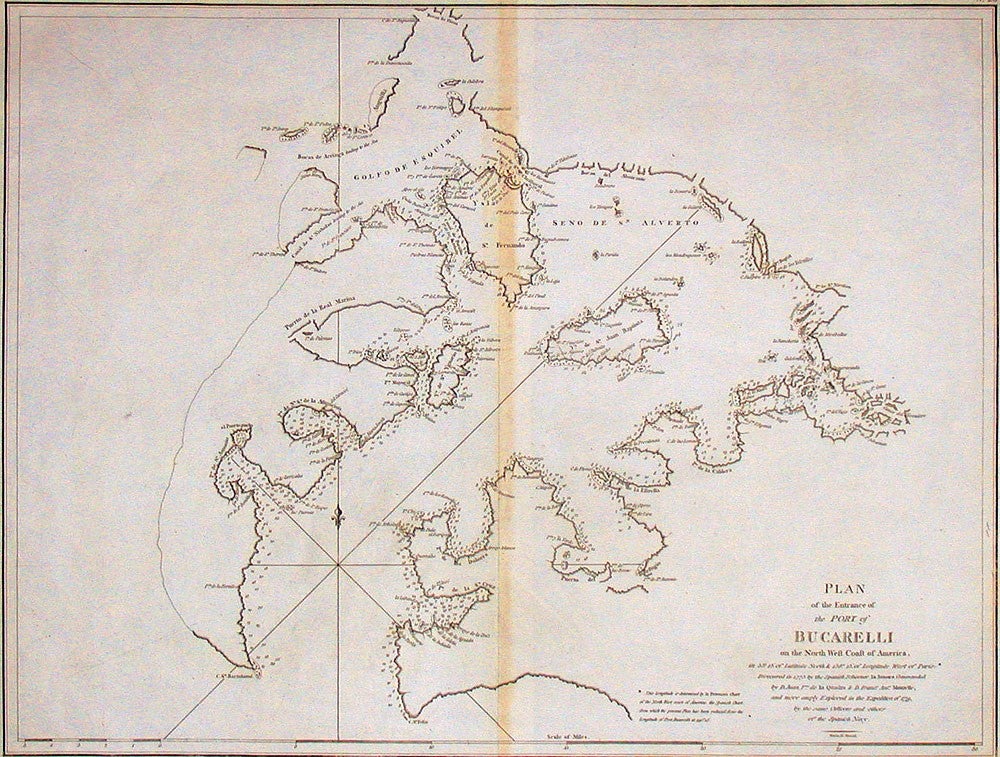
Plan of the Entrance of the Port of Bucarelli…
Plan of the Entrance of the Port of Bucarelli on the North West Coast of America…
London: Robinson, 1798.
Engraved map, 410 x 510 mm; with original central fold.
Rare Alaskan map
Fine and very detailed chart of Bucareli Sound in Alaska, prepared for the publication of La Pérouse's voyage, here in the English version. The engraving acknowledges its derivation from the mapping by Maurelle and Quadra on the Spanish expeditions of 1775 and 1779. The sound was named for New Spain's Viceroy - for some time it was thought to offer an entrance to the Northwest passage, which is why it was included in the publication of La Pérouse's voyage.
Fine and very detailed chart of Bucareli Sound in Alaska, prepared for the publication of La Pérouse's voyage, here in the English version. The engraving acknowledges its derivation from the mapping by Maurelle and Quadra on the Spanish expeditions of 1775 and 1779. The sound was named for New Spain's Viceroy - for some time it was thought to offer an entrance to the Northwest passage, which is why it was included in the publication of La Pérouse's voyage.
Bucarelli Sound is located about 50 miles west of Ketchikan. The chart shows many soundings around the harbor shoreline, and locates Golfo De Esquibel, Is. De St. Fernando, Is. St. Juan Baptista and Puerto de la Real Marina, also showing points and bays, channels and many small islands.
Wagner, Cartography of the North West Coast, 843 (French version).
Condition Report: Somewhat darkened at central fold.
Price (AUD): $975.00
US$624.88 Other currencies